General
Check the route and weather before you go.
- Stay aware of your surroundings; if something feels off, leave.
- Keep valuables out of sight and in separate places.
- Don't post your live location or schedule publicly.
An illustrated tile in place of a photo — we don't have a suitably licensed photo of this place yet.
ParkGazipur district· Dhaka Division
হাই-টেক সিটি, কালিয়াকৈর
Kaliakoir Hi–Tech Park or Hi–Tech City, Kaliakoir (HTCK) is a business park in Kaliakair of Gazipur District, Bangladesh. Originally called Kaliakoir Hi-Tech Park, after the municipality in which it is located, it was renamed in June 2016 to honor the founding president of Bangladesh, Sheikh Mujibur Rahman.
Summary: Wikipedia · CC BY-SA 4.0
Entry Fee
Standard / Free
Permit / Pass
Open Entry
Accessibility
Normal Access
Verified intelligence and latest changes for Hi-Tech City, Kaliakoir.
No recent updates recorded yet.
Real atmosphere, sights and recent reels from this tourist destination (Hi-Tech City, Kaliakoir)

Guy With A Backpack

Card&CraftTricks
Card&CraftTricks

Footsteps 👣
Doable year-round, but keep the monsoon and the weather in mind.
Check the route and weather before you go.
General guidance; check the weather and local conditions yourself before you go.
Position: 24.0662, 90.2268
This map is drawn by us: no outside map script is loaded. The links open an outside map when you tap them.
There are no separate local numbers for this district here. In an emergency, call 999.
Numbers can change. Re-check before you travel.
Know a verified contact? Suggest itIf the photo here is not good enough, send one you took. We review it before it appears on the site, with your credit under it.
Send a photo
The garden estate at Pirujali created by writer and filmmaker Humayun Ahmed, where he is also buried. Its trees, sculptures and pond make it a pilgrimage of sorts for his readers.
11 km away · Approximate
Palace in Dhaka district.
14 km away · Approximate
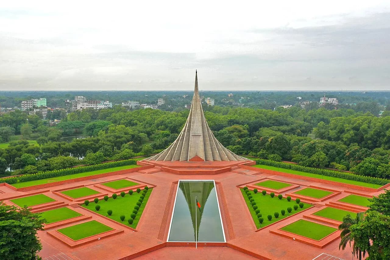
The memorial at Savar to those killed in the 1971 war: seven triangular planes rising over lakes and lawns. It is outside the city, so allow half a day.
17 km away · Approximate
Fruit
Gazipur jackfruit has geographical indication (GI) status. Around Sreepur and Kapasia, roadside stalls pile them high in June and July.
Gazipur, Bangladesh
2.1 km away
Source: OpenStreetMap
Gazipur, Bangladesh
4.3 km away
Source: OpenStreetMap
Tangail, Bangladesh
6 km away
Source: OpenStreetMap
Gazipur, Bangladesh
1.7 km away
Source: OpenStreetMap
Mawna - Fulbaria - Kaliakair - Dhamrai - Dulivita Rd
2.1 km away
Source: OpenStreetMap
Gazipur, Bangladesh
2.1 km away
Source: OpenStreetMap
Gazipur, Bangladesh
3.1 km away
24/7
Source: OpenStreetMap
খাজা বদরুদ্দোজা মডার্ণ হাসপাতাল (BHRF)
Source: OpenStreetMap
Source: OpenStreetMap
গ্রামীণ ব্যাংক
kaliakoir
2 km away
Source: OpenStreetMap
বাংলাদেশ কৃষি ব্যাংক · বাংলাদেশ কৃষি ব্যাংক
kaliakoir
2.1 km away
Source: OpenStreetMap
মা সিএনজি ফিলিং স্টেশন
Gazipur, Bangladesh
4.5 km away
Source: OpenStreetMap
Bangladesh Railway · হাইটেক পার্ক রেল ষ্টেশন
Gazipur, Bangladesh
0.8 km away
Source: OpenStreetMap
বাংলাদেশ রেলওয়ে · মৌচাক
Gazipur, Bangladesh
6.4 km away
Source: OpenStreetMap
Gazipur, Bangladesh
2.8 km away
Source: OpenStreetMap
Tangail, Bangladesh
6.9 km away
Source: OpenStreetMap
Tangail, Bangladesh
8.3 km away
Source: OpenStreetMap
Distances are in a straight line. Data from OpenStreetMap; check by phone or on the map before you go.
District information and sources
Spotted a mistake? Tell usIf something looks wrong or out of date, tell us and we'll check and fix it.